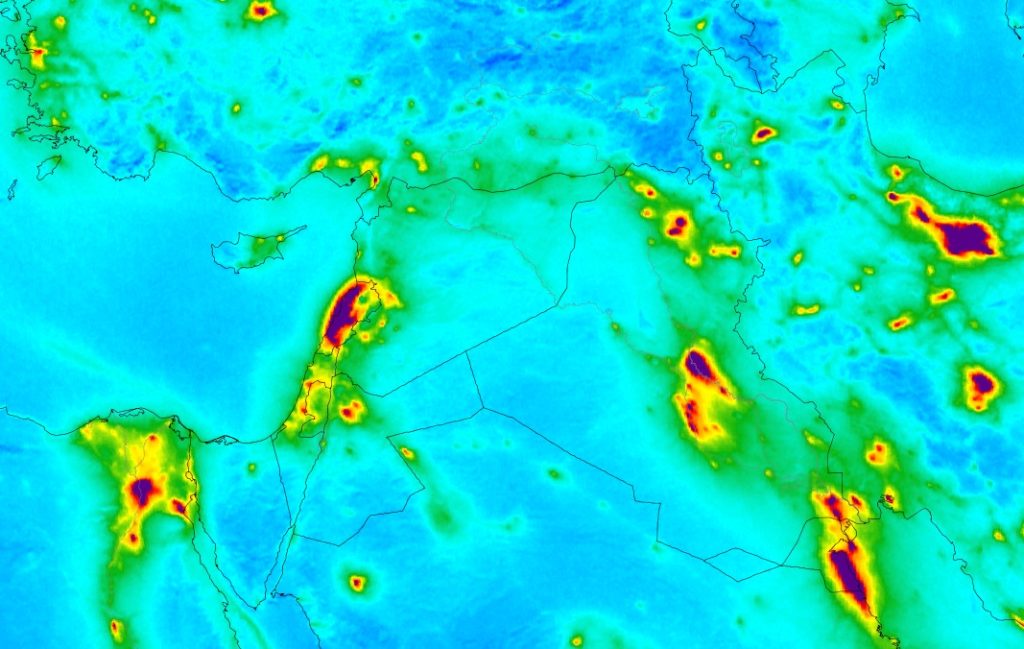
The European Space Agency (ESA) recently released several maps showing air pollution around the world after measuring the level of nitrogen dioxide over major cities using their Copernicus Sentinel-5P satellite.
This gas is an air pollutant that comes from traffic and the combustion of fossil fuel in industrial areas. And needless to say, it causes health issues by irritating the lungs and causing respiratory problems. The data was collected between April and September 2018 and the above image shows the result for part of the Middle East.
As you can see, almost all of Lebanon has very high levels of NO2 especially over the coast. And since we are by no means an industrial nation, the polluted air definitely comes from the massive number of cars and the diesel generators everywhere around the coutnry.
On the other hand, the government is as passive as ever with no plan in sight to make things better. In fact the best thing they have in mind now is to build garbage incinerators which they believe are eco-friendly. So expect the next results from the Copernicus to have Lebanon on the map replaced with a piece of shit. Literally.

No comments yet.